Laboratory
Laboratory’s Gallery
Infrastructure
Our Team
About Us
News
Research
Projects
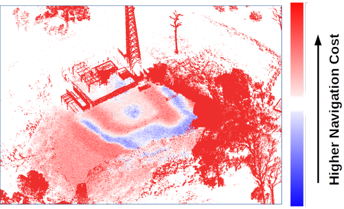
Three-dimensional Mapping with Augmented Navigation Cost
Cooperative Area Coverage Using Hexagonal Segmentation
Fenrir: 3D Printed Robotic Arm
Determining the Association of Individuals and the Collective Social Space
Semantic Description of Objects in Images Based on Prototype Theory
Semantic Mapping for Visual Robot Navigation
Detecting Landmarks On Different Domains Faces
Underwater Imaging
Project system of identification and multiview tracking for equipment and objects in Construction and Manufacturing.
Advanced teleoperation of mining equipment: excavator
Three-Dimensional Reconstruction from Large Image Datasets
Scene Understanding
HeRo: An Open Platform for Robotics Research and Education
Semantic Hyperlapse for First-Person Videos
Publications
Events
Social Media
Linkedin
Instagram
Twitter
YouTube
Contact
Restrict Area
Things we have done
All Projects
Three-dimensional Mapping with Augmented Navigation Cost
»
Next
Previous
»